
Here’s a Civil War map of Isle of Wight County and part of Nansemond County. In the image, I have labeled where Jones Grove Baptist Church is as well as where Tony and Moses Allmond’s lands were 30-40 years later.
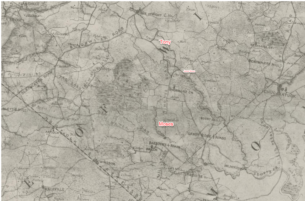
Many of the roads are the same and a lot of the parcels have the same boundaries.
Civil War maps are available at the Library of Congress: https://www.loc.gov/collections/civil-war-maps/about-this-collection/
