In 1870, Isaac Holleman purchased 50 acres in Windsor, near the Nansemond County line. He and his wife Ann raised their family there, and the land remained in the Holliman family until the 1960s. Although it had not been inhabited since a catastrophic fire in 1944, the land endured.
Early last year, we visited the land with permission from the current owner and tenant. This video documents that visit. It is not a reconstruction, but a witnessing of what remains, what has changed, and what still holds memory.
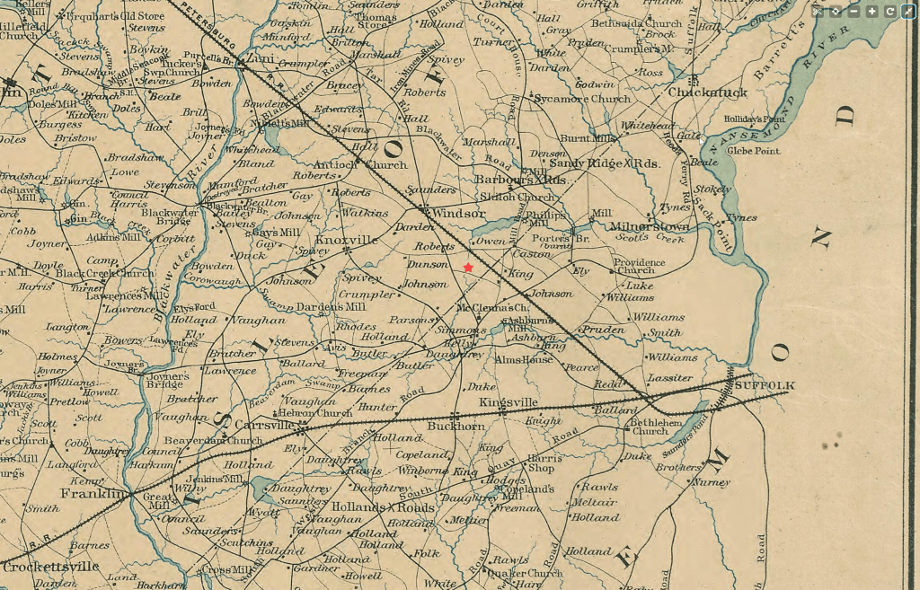
I will tell you that I eyeballed this Civil War map to place this star, and I think I did a good job figuring out where to put it. I’m pretty sure it’s accurate.
In more recent years, the land has been documented in an environmental study conducted by the former Norfolk and Western Railway Company, which describes its history and condition. I’ve included screenshots to show the level of detail about the land. (More of the document is linked at the bottom of the post.)
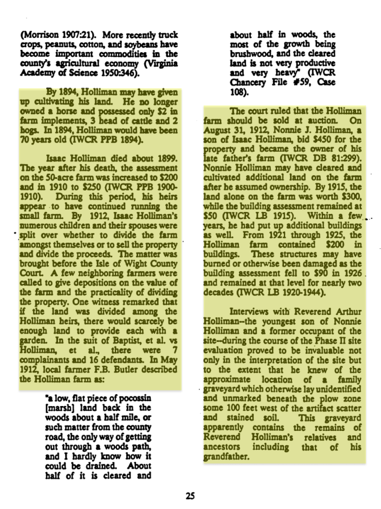
Some highlights from the document include:
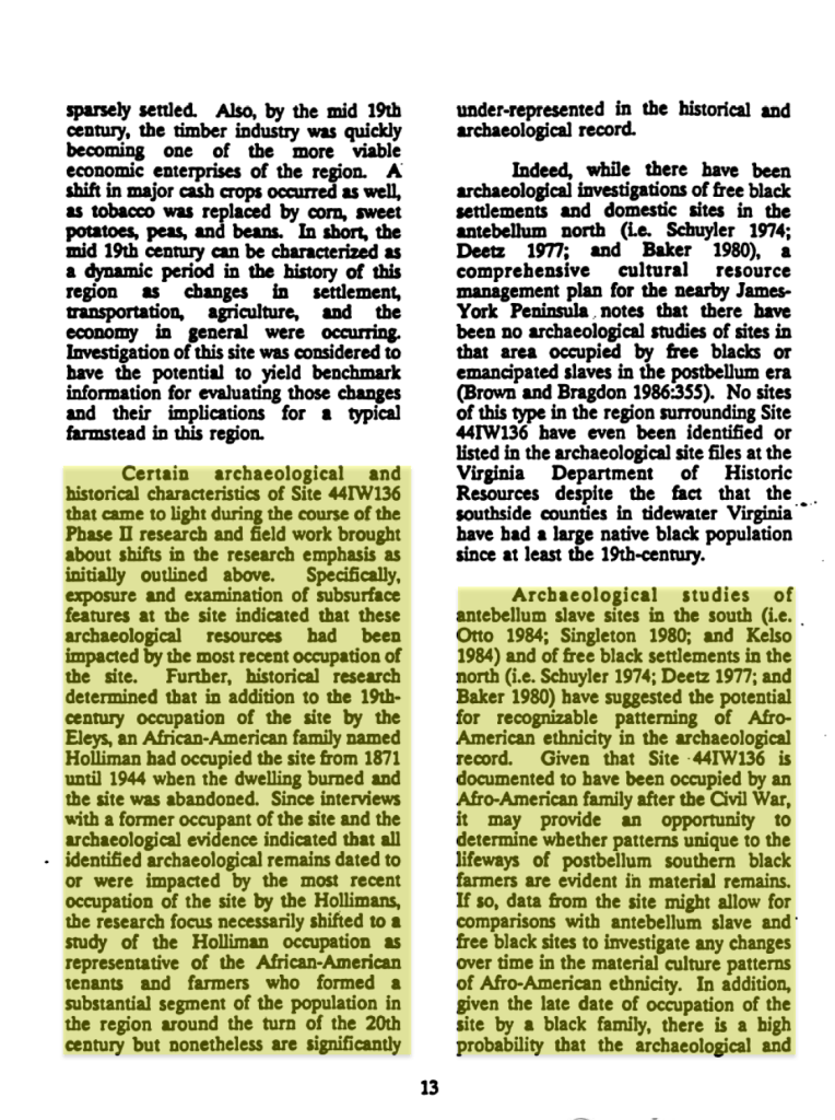
Site 44IW136 is an archaeological site located in Isle of Wight County, Virginia, identified within the project area for a proposed coal ground storage facility for the Norfolk and Western Railway Company. The site is situated on a level, poorly drained field of Yemassee fine sandy loam approximately 2,500 feet east of Route 608.
Historical Occupation Archival research and archaeological evidence indicate the site was occupied from the early 19th century until 1944. The property history includes:
- The Eley Family: The land was likely part of a tract patented by the Eley family as early as the late 17th century. By the mid-1810s, Cary Eley and his family occupied the site, operating a modest farmstead. Due to debt, Eley lost ownership in 1860 but likely remained as a tenant.
- The Holliman Family: Following the Civil War, the site was owned and occupied by the Hollimans, an African-American family. Occupation ceased when the dwelling burned down in 1944.
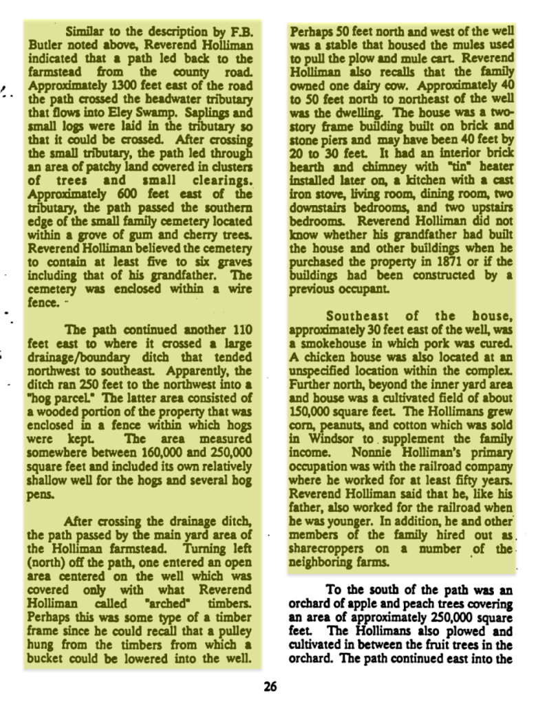
- Oral History: Interviews with a former occupant, Reverend Arthur Holliman, provided critical information regarding the farmstead’s spatial layout, subsistence activities, and the location of a family graveyard.
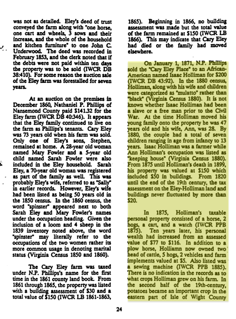
Archaeological Findings A Phase II archaeological evaluation conducted in 1990 and 1991 involved controlled surface collection and mechanical stripping of the plow zone to expose subsurface features. Key findings included:
- Features: A total of 137 features were identified. These included a filled well, the possible subsurface remains of a smokehouse, and drainage ditches. No subsurface remains of the dwelling were found, which aligned with Reverend Holliman’s recollection that the house stood on piers of stacked stone and brick.
- Cemetery: An unmarked family graveyard containing twelve graves was identified approximately 100 feet west of the artifact scatter. Five of the graves appeared to be those of infants, and the cemetery includes the remains of Reverend Holliman’s grandfather.
- Artifacts: A total of 2,680 artifacts were recovered, dominated by kitchen group artifacts (74.4%) and architectural artifacts (22.1%). Recovered items included ceramics (whiteware, ironstone, stoneware, porcelain), glass bottle fragments, tools, and toys such as marbles.
Today, the property is owned by Norfolk Southern Railroad and is farmed via lease as the coal storage facility was never built.
Sources:
- Confederate States Of America. Army Of Northern Virginia. Engineer Office, Bien, J., Campbell, A. H. & Patton, J. H. (1891) Preliminary map of a part of the south side of James River, Va.: from surveys and reconnaissances. [Washington: GPO, between to 1893] [Map] Retrieved from the Library of Congress, https://www.loc.gov/item/lva0000171/.
- Norfolk and Western Railway Company Ground Coal Storage Facility, Isle of Wight County: Environmental Impact Statement. (1993). United States: (n.p.). Excerpt from Norfolk and Western Railway Company Study – Archeological Survey-compressed
